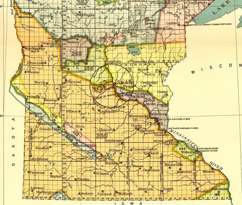
1899 Bureau of American Ethnology Land Acquisition Map for the state of Minnesota
Item
- Title
- 1899 Bureau of American Ethnology Land Acquisition Map for the state of Minnesota
- Description
- A map by Charles C. Royce for the 1899 Bureau of American Ethnology, showing all land cessions made through all treaties between Native tribes in the state of Minnesota. The darker highlighted line indicated the boundary between Dakota and Ojibwe land laid out by the Treaty of Prairie du Chien in 1825. The city of St. Cloud lies just on the border of this boundary.
- Creator
-
Charles C. Royce
Cyrus Thomas - Source
-
Smithsonian Institution. Bureau of American Ethnology. Eighteenth annual report ... 1896-'97. pt. 2, p. 521-997, 67 maps (part double). 30 cm.
- Date
- 1899
- Rights
- Smithsonian Institution
- Format
- Book/ Printed Material
- Language
- English
- Type
- Map


